A bible atlas is a book that can help anyone, from a new Christian to a professional scholar, understand Scripture better.
Like bible concordances, dictionaries, and commentaries, an atlas is one of the foundation tools that many Christians have in their personal library because they are helpful, easy to use, and affordable. So what exactly is a bible atlas?

In general, an atlas is a book of charts and maps of the Earth, some of which focus on only one region of the Earth or one time period in history. A bible atlas contains maps and charts related to the Old and New Testament.
For example, a map in a bible atlas may depict Israel’s departure from Egypt, and trace their route to Mt. Sinai, then through the 40 years of wandering, before eventually arriving at the Promised Land.
A chart in a bible atlas may include timelines of the Apostle Paul’s three missionaries journeys as they are recorded in Acts and the letters he wrote.
Also see What is a Bible Concordance? to learn more.
Where does the word “atlas” come from? The word “atlas” was coined by the German geographer, Gerardus Mercator, who published one of the first atlas’ of the Earth in 1595.
Mercator was fond of the character, Atlas, who was a Titan of Greek mythology. Mercator believed Atlas was a great geographer and named his book after him.
As a result, books of maps and charts — and now 3D displays, interactive websites, and phone apps — are commonly referred to as atlases.
Bible Atlases: Features
There are many ways that bible atlases visual depict the story of Scripture to help readers. It’s one thing to read that God called Abram out of Ur and to the Promised Land. It’s another thing to geographically trace the terrain he walked with his family. Seeing a map of Abram’s experience deepens the reader’s understanding of what God called Abram to do and also provides more insight into what obedience entails.
Here are some of the common features of bible atlases:
Geographical maps: The geography of Israel is given special attention because it is central to the narrative of both testaments. There are also multiple depictions of Israel included because, while its the same land mass, through the centuries its national and regional borders shifted and cities were destroyed and others were established. In the book of Joshua, boundaries were based on tribes. In 1 and 2 Samuel, boundaries were based on the extent of a king’s military victories. In 2 Kings, boundaries were based on the divided kingdom. Bible atlases contain maps of each of these time periods and several others as well.
Besides Israel, the geography of nations that are important to the biblical story are also featured in bible atlases. The land of Mesopotamia is important to Genesis, so it’s illustrated. The land of Egypt, including The Nile and The Red Sea, is important to Exodus so it is illustrated. The land of Persia is important to Esther, so it’s illustrated. The Roman Empire is the geographical and political background for the entire New Testament so it is illustrated in detail.

Weather patterns: Weather plays a key role in certain biblical stories, and not just supernatural events such as the worldwide flood or Elijah’s prophecy concerning rain prevention. For example, certain festivals and celebrations that are explained in the book of Leviticus, but practiced throughout the Old Testament, were based on seasons and harvests, both of which are related to weather patterns.
The climate of Israel affected the day-to-day life of the people who lived there. To understand their life and story, it’s helpful to have familiarity with basic information. There are often charts in bible atlases showing that Israel had a rainy season, a dry season, and some transitional months as well. Other charts show averages temperatures, as well as highs and lows, arranged by geographical location, like mountains and vallyes, and regions, such as coastlines and deserts.
Travel routes: Roads and waterways are commonly illustrated and described in bible atlases. Roads could be local or international routes used for travel and trade. Certain roads carried unique products relative to the region where they were, like food, copper, iron, silver, gold, incense, and dyes. Roads of the Roman Empire are often identified because they are historically famous. Boats, and other forms of water transportation were used for travel, especially during the rainy season.
Historical descriptions often include the following features:
- Genesis: This section illustrates the Garden of Eden as it’s described in Genesis 1-2 and the Table of Nations as it’s described in Genesis 10. Early Mesopotamia and early Egypt are also discussed because of the role they play in the biblical story.
- Exodus: These maps depict Egypt during Israel’s captivity, the Exodus route, the stay at Mt. Sinai, the wilderness wanderings, and settlement in the Promised Land.
- The Promised Land: Cities of refuge in the Promised Land are also identified. Also included are maps related to the book of Judges and the military rulers who held power during that time. For example, the regions where Deborah, Samson, and Gideon ruled are all identified.
- Monarchy and Exile: These maps include geographical outlines of each king of Israel and Judah. The route of the exiles from Israel went into Persia is also identified.
- Between the Testaments: There is approximately 400 years between the Old and New Testament. The Grecan and Roman Empire are both prominent during this time, as are local regional Jewish leaders.
- New Testament: New Testament maps include those that cover the life of Christ and Paul’s life and ministry. The life of Christ includes his birth and escape to Egypt, his ministry in and around Galilee, as well as his time in Jerusalem. Maps of Paul trace his three missionary journeys as well as his journey to Rome.
Well-Reviewed Bible Atlases
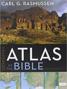
Zondervan Atlas of the Bible Hardcover by Carl G. Rasmussen


Winner: Gold Medallion Book Award
Description: The first section of the Atlas introduces the “playing board” of biblical history―using three–dimensional maps and photographic images to help the lands of the Bible come alive. The next section, arranged historically, begins with Eden and traces the historical progression of the Old and New Testaments. It provides an engaging, accurate, and faithful companion to God’s Word―illuminating the text with over one hundred full-color, multidimensional maps created with the help of Digital Elevation Modeling data.
It concludes with chapters on the history of Jerusalem, the disciplines of historical geography, and the most complete and accurate listing and discussion of place-names found in any atlas. Throughout the Atlas, innovative graphics, chronological charts, and over one hundred specially selected images help illuminate the geographical and historical context of biblical events. The Zondervan Atlas of the Bible is destined to become a favorite guide to biblical geography for students of the Bible. This accessible and complete resource will assist you as you enter into the world of the Bible as never before.
Holman Bible Atlas: A Complete Guide to the Expansive Geography of Biblical History


Winner: ECPA Gold Medallion Book Award
Description: The Holman Bible Atlas is the leading Bible atlas in the English language. Through the use of 132 full-color maps, more than 100 color photographs, timelines, chart summaries, and helpful sidebars, it places readers in the geographical, historical, and cultural contexts of the Bible and enables them to experience its perennially relevant message.
The book is presented in two broad divisions: physical geography of the Ancient Near East and biblical history periods from the patriarchs to the Christian era until Constantine. The content is arranged in line with specific biblical texts so that teachers, pastors, and students will see the key events of the Bible and Christianity with exceptional clarity.
There’s also a wealth of written and visual information regarding various people groups (Aramaeans, Moabites, Phoenicians, etc.), great empires (Egypt, Babylonia, Rome, etc.), and the road systems, agricultural year, and economic life of ancient civilizations based on archaeological recoveries.
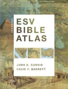
Crossway ESV Bible Atlas


Description: Capitalizing on recent advances in satellite imaging and geographic information systems, the Crossway ESV Bible Atlas offers Bible readers a comprehensive, up-to-date resource that blends technical sophistication with readability, visual appeal, and historical and biblical accuracy.
All the key methods of presenting Bible geography and history are here, including more than 175 full-color maps, 70 photographs, 3-D re-creations of biblical objects and sites, indexes, timelines, and 65,000 words of narrative description. The atlas uniquely features regional maps detailing biblically significant areas such as Egypt, Mesopotamia, Italy, and Greece. It also includes access to online maps and illustrations.
This carefully crafted reference tool not only sets a new standard in Bible atlases but will help ESV readers more clearly understand the world of the Bible and the meaning of Scripture.
Also see What is a Chronological Bible?
Also see What Is a Bible Handbook?

